|
General
conclusions
The main purpose of the buried valley amapping project has been to identify and localise occurrences of buried valleys and describe and compare their characteristics. It has also been a purpose to describe the origin of the buried valleys and the machanisms involved.
The number of buried valleys in Denmark is large and because the valleys in many areas have a great importance for the groundwater resources it is important to get a thorough knowledge of the valleys and their formation. The results of the mapping also have great importance in relation to other types of geological surveys.
By the end of 2021, more than 5,600 km buried valleys have been mapped. This number is far from the total number of subsurface valleys because only around half of the Danish area has been mappet so far and because not all valleys can be delineated with the mapping methods presently used.
The data used in the mapping project are primarily TEM data, seismic profiles and borehole data. TEM/SkyTEM surveys covering large areas have proven necessary for successfully mapping the buiried valleys because borehole data alone cannot give the complete picture of the valleys. The borehole data add lithological information and i.e. seismic profiles add information on structure.
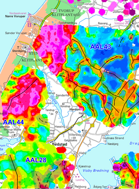
The buried valleys have been mapped at more than 280 different localities and the geological descriptions and interpretations from these localities form the backbone of the results of the mapping project listed below:
Geographical occurrence and dimensions
• The buried valleys are present in all of Denmark
• The buried valleys are typically between 25 og 400 meter deep and between 0,5 og 3,5 km wide
The valley form
• The valley flanks can be very steep
• The valleys often have abrupt terminations and the valley floors show occational overdeepenings and thresholds
• The valleys are eroded into all kinds of sediments; limestone and chalk, silts, sands and clays
• The valleys are eroded into both Quaternary and Tertiary sediments - and occationally also sediments of the Upper Cretaceous
The valley infill
• The valleys often have a complex architecture with multiple erosions within the same overall valley trace and often the infill sediments are glaciotectonically deformed
• The infill of the valleys always consists of Quaternary sediments
• There are typically differences in the character of the infill in different parts of the country
• Often meltwater clays and/or interglacial sediments are found in the valleys
The origin of the buried valleys
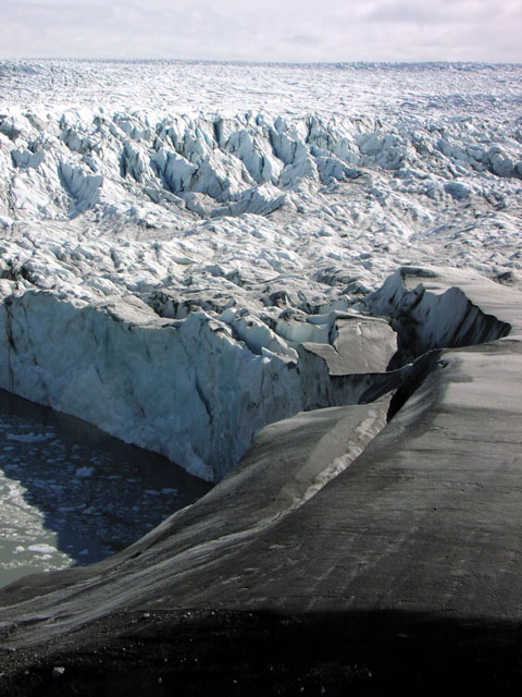
• The buried valleys have been formed as tunnel valleys during the Quaternary. Sediments from the at least three glacials and two interglacials have been found in the valleys
•The buried valleys are predominantly formed as tunnel
valleys underneath the glacier ice. The valleys were eroded by high pressure meltwater supposed to have drained from subglacially stored reservoirs
• The buried valleys
can be divided into different generations. The valleys often
cross-cut each other and sometimes have varying preferred
orientations. A complicated pattern with three to five
generations of valleys can often be distinguished in areas with
high data resolution.
• Existing buried valleys with orientations parallel to a new ice advance appears to have a larger chance of being re-used as a subglacial valley. Valleys with perpendicular to the ice advance, however, seem to be more prone to total burial during subsequent ice advances
• Salt structures in the subsurface have locally influenced the formation of buried valleys
Connections between the occurrence of buried valleys and geological structures of the subsurface
• Faults are mapped undeneath some of the buried valleys
• A relationship between the orientations of the topographic valleys and the buried valleys shows that analyses of the terrain can be used for delineation of buried valleys
• Clear relationships between orientations of deep-seated faults, buried valley orientations and topographical valleys points to an impact from the structural framework on the formation of valleys - both the tunnel valleys and the erosional valleys in the terrain. Reactivations of old fault zones caused by the weight relief from the ice sheets have apparrently had an impact on the erosional patterns during the Quaternary
New angles to the understanding of the Quaternary sedimentary sequence
• The buried valleys contain sediments representing a series of geological events which have not necessarily been preserved in the succession outside the buried valleys. The preservation potential of i.e. the interglacial sediments are considered to be high and the valleys are therefore good Quaternary archives
|